
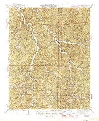
1945 Map of Berryman
USGS Topo · Published 1945About this map
Huzzah Creek and Courtois Creek carve deep through this portion of the Clark National Forest, creating a landscape defined by sharp ridges and narrow hollows in the mid-1940s. The settlement at Berryman serves as a central point, surrounded by a network of rural schools and churches such as Berryman Sch and the Ozark Gospel Center. This era in Crawford County and Washington County shows a reliance on topographic high points for fire observation, with both the Westover Lookout and Czar Lookout positioned to monitor the surrounding timberlands.
Find a feature on this map
111 named features on this map. Tap any name to fly to it.
Don’t see what you’re looking for? This feature index may not catch every label — zoom into the map to look around manually.
Map Details
Editions of this 1945 Berryman Map
2 editions found
Other maps of this area

1901 · De Soto
USGS Topo · 1:125,000

1903 · Sullivan
USGS Topo · 1:125,000

1906 · Potosi
USGS Topo · 1:62,500

1924 · Edgehill
USGS Topo · 1:62,500

1926 · Edgehill
USGS Topo · 1:62,500

1932 · Steelville
USGS Topo · 1:48,000

1933 · Steelville
USGS Topo · 1:62,500

1937 · Steelville
USGS Topo · 1:62,500

1941 · Stone Hill
USGS Topo · 1:62,500

1943 · Berryman
USGS Topo · 1:62,500