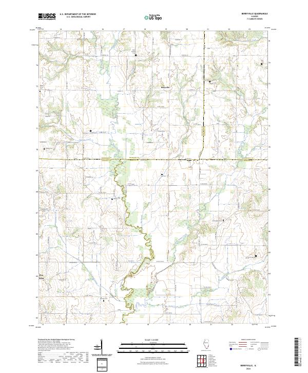
2024 Map of Berryville
USGS Topo · Published 2024About this map
Berryville and the eastern outskirts of West Salem anchor this landscape at the intersection of four Illinois counties. The terrain is defined by a dense network of watercourses, including Bonpas Creek, Little Bonpas Creek, and Jordan Creek, which create a complex drainage pattern across the Richland, Edwards, Wabash, and Lawrence county lines. This area is particularly notable for its high concentration of family and community burial grounds, which serve as primary markers for the region's genealogical history. From Shiloh Number 1 Cem in the north to Pinhook Cem and Jordan Creek Cem in the south, these sites delineate the historic settlement clusters of the rural townships. The map reveals a transition from the structured grid of county roads like Co RD 13 and N Wabash RD to the winding paths dictated by the riparian corridors of Crooked Creek and Big Branch.
Find a feature on this map
82 named features on this map. Tap any name to fly to it.
Don’t see what you’re looking for? This feature index may not catch every label — zoom into the map to look around manually.
Map Details
Editions of this 2024 Berryville Map
This is the sole edition of this map. No revisions or reprints were ever made.
Other maps of this area

1903 · Patoka
USGS Topo · 1:125,000

1904 · Mount Carmel
USGS Topo · 1:62,500

1911 · Sumner
USGS Topo · 1:62,500

1913 · Sumner
USGS Topo · 1:62,500

1943 · Albion
USGS Topo · 1:62,500

1946 · Albion
USGS Topo · 1:62,500

1949 · Olney
USGS Topo · 1:62,500

1956 · Vincennes
USGS Topo · 1:250,000

1957 · Vincennes
USGS Topo · 1:250,000

1958 · Vincennes
USGS Topo · 1:250,000