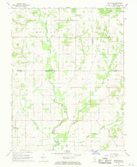
1968 Map of Berryville
USGS Topo · Published 1969About this map
Bonpas Creek meanders through this landscape at the intersection of Richland, Lawrence, Edwards, and Wabash counties in the late 1960s. The area is defined by its agricultural character and an underlying extractive economy, evidenced by numerous Oil Wells and a Drill Hole scattered across the rural sections. A significant historical line, the Old Indian Treaty Boundary, cuts diagonally across the eastern half of the map, marking an older era of land division that persists in the modern survey.
Find a feature on this map
29 named features on this map. Tap any name to fly to it.
Don’t see what you’re looking for? This feature index may not catch every label — zoom into the map to look around manually.
Map Details
Editions of this 1968 Berryville Map
This is the sole edition of this map. No revisions or reprints were ever made.
Other maps of this area

1903 · Patoka
USGS Topo · 1:125,000

1904 · Mount Carmel
USGS Topo · 1:62,500

1911 · Sumner
USGS Topo · 1:62,500

1913 · Sumner
USGS Topo · 1:62,500

1943 · Albion
USGS Topo · 1:62,500

1946 · Albion
USGS Topo · 1:62,500

1949 · Olney
USGS Topo · 1:62,500

1956 · Vincennes
USGS Topo · 1:250,000

1957 · Vincennes
USGS Topo · 1:250,000

1958 · Vincennes
USGS Topo · 1:250,000