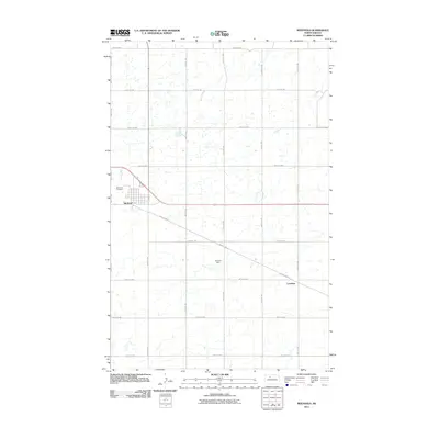
2011 Map of Berthold
USGS Topo · Published 2011About this map
Berthold serves as the primary hub for this agricultural portion of Ward County, organized around a rigid grid of range and township lines. The settlement’s northwestern edge is marked by the Wild Rose Cemetery, while the surrounding landscape is defined by the prairie pothole region's characteristic small water bodies and seasonal wetlands. These natural depressions are interspersed between an extensive network of rural roads such as 128th Ave NW and 296th St NW.
Find a feature on this map
18 named features on this map. Tap any name to fly to it.
Don’t see what you’re looking for? This feature index may not catch every label — zoom into the map to look around manually.
Map Details
Editions of this 2011 Berthold Map
This is the sole edition of this map. No revisions or reprints were ever made.
Other maps of this area

1949 · Hartland
USGS Topo · 1:24,000

1949 · Carpio NE
USGS Topo · 1:24,000

1949 · Carpio
USGS Topo · 1:24,000

1950 · Des Lacs
USGS Topo · 1:24,000

1954 · Minot
USGS Topo · 1:250,000

1958 · Minot
USGS Topo · 1:250,000

1980 · Minot
USGS Topo · 1:100,000

1980 · Rice Lake NW
USGS Topo · 1:24,000

1980 · Tagus SE
USGS Topo · 1:24,000
1980 · Berthold
USGS Topo · 1:24,000