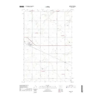
2017 Map of Berthold
USGS Topo · Published 2017About this map
Berthold serves as the primary hub in this portion of Ward County, organized around a traditional street grid with Main St N, Main St S, and Central Ave E forming its core. Just to the northwest, Wild Rose Cem provides a local genealogical landmark. The surrounding landscape is defined by the prairie's drainage patterns, characterized by several named coulees that cut through the terrain. These include Arnold Coulee in the north and the sprawling Lonetree Coulee near the settlement of Lonetree. The map illustrates a highly regularized section line road system, with routes like 128th Ave NW and 282nd St NW providing access to the agricultural parcels that dominate the region's economy and settlement pattern.
Find a feature on this map
39 named features on this map. Tap any name to fly to it.
Don’t see what you’re looking for? This feature index may not catch every label — zoom into the map to look around manually.
Map Details
Editions of this 2017 Berthold Map
This is the sole edition of this map. No revisions or reprints were ever made.
Other maps of this area

1949 · Hartland
USGS Topo · 1:24,000

1949 · Carpio NE
USGS Topo · 1:24,000

1949 · Carpio
USGS Topo · 1:24,000

1950 · Des Lacs
USGS Topo · 1:24,000

1954 · Minot
USGS Topo · 1:250,000

1958 · Minot
USGS Topo · 1:250,000

1980 · Minot
USGS Topo · 1:100,000

1980 · Rice Lake NW
USGS Topo · 1:24,000

1980 · Tagus SE
USGS Topo · 1:24,000
1980 · Berthold
USGS Topo · 1:24,000