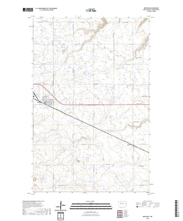
2024 Map of Berthold
USGS Topo · Published 2024About this map
Berthold sits as the primary hub of this Ward County landscape, where the street grid of the town center meets the expansive agricultural section lines of the North Dakota prairie. The geography is defined by a series of glacial drainage patterns, most notably Lonetree Coulee and Tasker Coulee, which carve subtle relief into the predominantly level terrain. Near the town site, the Wild Rose Cem provides a point of genealogical interest, while the small settlement of Lonetree marks a secondary point of activity along the southern transit corridor. A dense network of township roads, such as 128th Ave NW and 254th St NW, creates a rigid geometric overlay across the natural coulees, illustrating the systematic land division that has shaped this region's farming heritage for generations.
Find a feature on this map
38 named features on this map. Tap any name to fly to it.
Don’t see what you’re looking for? This feature index may not catch every label — zoom into the map to look around manually.
Map Details
Editions of this 2024 Berthold Map
This is the sole edition of this map. No revisions or reprints were ever made.
Other maps of this area

1949 · Hartland
USGS Topo · 1:24,000

1949 · Carpio NE
USGS Topo · 1:24,000

1949 · Carpio
USGS Topo · 1:24,000

1950 · Des Lacs
USGS Topo · 1:24,000

1954 · Minot
USGS Topo · 1:250,000

1958 · Minot
USGS Topo · 1:250,000

1980 · Minot
USGS Topo · 1:100,000

1980 · Rice Lake NW
USGS Topo · 1:24,000

1980 · Tagus SE
USGS Topo · 1:24,000
1980 · Berthold
USGS Topo · 1:24,000