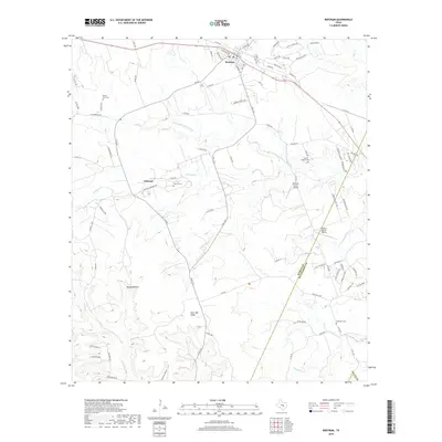
2019 Map of Bertram
USGS Topo · Published 2019About this map
Bertram serves as the primary hub of this landscape, situated near the intersection of several regional routes like FM 243 and FM 1174. To the southwest lies the community of Oatmeal, a location with deep roots reflected in the nearby Oatmill Cem. The terrain is defined by the winding course of the S Fork San Gabriel River and its various tributaries, including Oatmeal Cr and Little Cr. Further south, the elevation rises toward Post Oak Ridge and the distinctive landmark known as Buzzard Roost, illustrating the transition from river valleys to higher upland reaches. Local history is anchored by several burial grounds, including Mount Zion Cem and Hopewell Cem, while the presence of the McFarlin Ranch Airport and Liberty Hill Air Ranch highlights the rural aviation infrastructure of the modern era. The map also delineates the boundary where Burnet County meets Williamson County.
Find a feature on this map
96 named features on this map. Tap any name to fly to it.
Don’t see what you’re looking for? This feature index may not catch every label — zoom into the map to look around manually.
Map Details
Editions of this 2019 Bertram Map
This is the sole edition of this map. No revisions or reprints were ever made.
Other maps of this area

1887 · Burnet
USGS Topo · 1:125,000

1893 · Georgetown
USGS Topo · 1:125,000

1893 · Burnet
USGS Topo · 1:125,000

1903 · Burnet
USGS Topo · 1:125,000

1909 · Burnet
USGS Topo · 1:125,000

1932 · Bertram
USGS Topo · 1:62,500

1954 · Llano
USGS Topo · 1:250,000

1954 · Austin
USGS Topo · 1:250,000

1955 · Llano
USGS Topo · 1:250,000

1956 · Llano
USGS Topo · 1:250,000