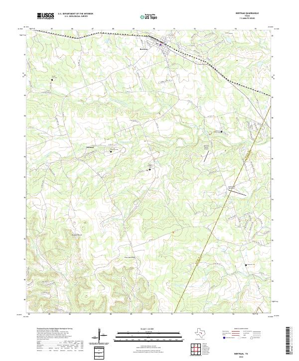
2022 Map of Bertram
USGS Topo · Published 2022About this map
The S Fork San Gabriel River cuts through the limestone-inflected terrain of eastern Burnet County, where long-established rural communities and family burial grounds dot the landscape. The city of Bertram sits at the northern edge of the map, while the historic settlement of Oatmeal remains a focal point to the southwest. This area is particularly rich for genealogical research, preserving the locations of several community cemeteries including Mount Zion Cem, Negro Stringtown Cem, and South San Gabriel Cem. The topographic relief is defined by Post Oak Ridge and the drainage patterns of Oatmeal Cr and Dog Br. From the cattle-ranching legacy at Buzzard Roost to the complex network of county roads, the map documentation tracks the persistence of small Texas Hill Country settlements against a backdrop of increasing rural development.
Find a feature on this map
94 named features on this map. Tap any name to fly to it.
Don’t see what you’re looking for? This feature index may not catch every label — zoom into the map to look around manually.
Map Details
Editions of this 2022 Bertram Map
This is the sole edition of this map. No revisions or reprints were ever made.
Other maps of this area

1887 · Burnet
USGS Topo · 1:125,000

1893 · Georgetown
USGS Topo · 1:125,000

1893 · Burnet
USGS Topo · 1:125,000

1903 · Burnet
USGS Topo · 1:125,000

1909 · Burnet
USGS Topo · 1:125,000

1932 · Bertram
USGS Topo · 1:62,500

1954 · Llano
USGS Topo · 1:250,000

1954 · Austin
USGS Topo · 1:250,000

1955 · Llano
USGS Topo · 1:250,000

1956 · Llano
USGS Topo · 1:250,000