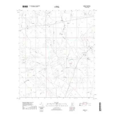
2018 Map of Berwick
USGS Topo · Published 2018About this map
Ariel and Berwick are central to this portion of Amite County, where the landscape is defined by the winding paths of Beaver Creek and its many tributaries. The area is exceptionally dense with family burial grounds and community cemeteries, providing a detailed record of local genealogy through names like Issac Jackson Cem, Rainey Cem, and Smylie Cem. Smaller settlements such as Olio and Capell are connected by a network of rural routes, including Lower Centreville Rd and Berwick Cassels Rd. The terrain is characterized by intricate drainage patterns from Berry Cr, Mill Cr, and Causey Cr, which have shaped the settlement patterns and agricultural boundaries of the region. This survey captures the rural character of southwestern Mississippi, documenting established churches and family landmarks like Spring Hill Cem and Rose Hill Cem that anchor these small communities.
Find a feature on this map
77 named features on this map. Tap any name to fly to it.
Don’t see what you’re looking for? This feature index may not catch every label — zoom into the map to look around manually.
Map Details
Editions of this 2018 Berwick Map
This is the sole edition of this map. No revisions or reprints were ever made.
Other maps of this area

1906 · Bayou Sara
USGS Topo · 1:125,000

1941 · Woodland
USGS Topo · 1:31,680

1941 · Norwood
USGS Topo · 1:31,680

1941 · Chipola
USGS Topo · 1:31,680

1945 · Norwood
USGS Topo · 1:31,680

1945 · Chipola
USGS Topo · 1:31,680

1953 · Natchez
USGS Topo · 1:250,000

1954 · Baton Rouge
USGS Topo · 1:250,000

1956 · Natchez
USGS Topo · 1:250,000

1956 · Baton Rouge
USGS Topo · 1:250,000