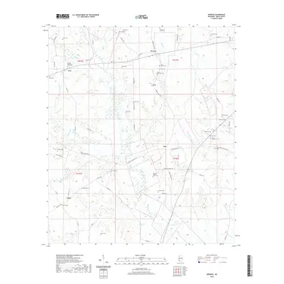
2020 Map of Berwick
USGS Topo · Published 2020About this map
Berwick and the surrounding Amite County countryside are defined by a network of family-named cemeteries and small community nodes in this 2020 record. The landscape is deeply etched by the headwaters of Beaver Creek and Centreville Cr, where historical settlements like Ariel and Olio served as local anchors for rural life. Genealogists will find a high density of burial sites reflecting the area's long-standing family ties, including the Bethany Presbyterian Church Cem and Thomas Causey Cem. The map reveals how modern roads like Berwick Cassels Rd and Lower Centreville Rd follow the logic of the terrain, connecting isolated homesteads to the village centers. From the northern reaches of Berry Cr to the southern boundaries near Capell, the survey documents a region where the continuity of place is preserved through its churches and named landmarks.
Find a feature on this map
72 named features on this map. Tap any name to fly to it.
Don’t see what you’re looking for? This feature index may not catch every label — zoom into the map to look around manually.
Map Details
Editions of this 2020 Berwick Map
This is the sole edition of this map. No revisions or reprints were ever made.
Other maps of this area

1906 · Bayou Sara
USGS Topo · 1:125,000

1941 · Woodland
USGS Topo · 1:31,680

1941 · Norwood
USGS Topo · 1:31,680

1941 · Chipola
USGS Topo · 1:31,680

1945 · Norwood
USGS Topo · 1:31,680

1945 · Chipola
USGS Topo · 1:31,680

1953 · Natchez
USGS Topo · 1:250,000

1954 · Baton Rouge
USGS Topo · 1:250,000

1956 · Natchez
USGS Topo · 1:250,000

1956 · Baton Rouge
USGS Topo · 1:250,000