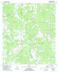
1988 Map of Berwick
USGS Topo · Published 1988About this map
Berwick and Ariel anchor a landscape defined by the winding drainages of Beaver Creek and Berry Creek in this late 20th-century survey. The area is dense with community landmarks that provide significant value for genealogical research, including numerous rural burial grounds like Smiley Cem and Rose Hill Cem. The settlement pattern follows the high ground between creek branches, with small centers of activity clustered around local institutions such as Jerusalem Ch and Bethany Ch.
Find a feature on this map
42 named features on this map. Tap any name to fly to it.
Don’t see what you’re looking for? This feature index may not catch every label — zoom into the map to look around manually.
Map Details
Editions of this 1988 Berwick Map
This is the sole edition of this map. No revisions or reprints were ever made.
Other maps of this area

1906 · Bayou Sara
USGS Topo · 1:125,000

1941 · Woodland
USGS Topo · 1:31,680

1941 · Norwood
USGS Topo · 1:31,680

1941 · Chipola
USGS Topo · 1:31,680

1945 · Norwood
USGS Topo · 1:31,680

1945 · Chipola
USGS Topo · 1:31,680

1953 · Natchez
USGS Topo · 1:250,000

1954 · Baton Rouge
USGS Topo · 1:250,000

1956 · Natchez
USGS Topo · 1:250,000

1956 · Baton Rouge
USGS Topo · 1:250,000