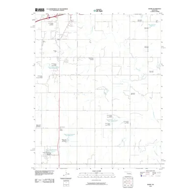
2010 Map of Bessie
USGS Topo · Published 2010About this map
The town of Bessie anchors this western Oklahoma landscape, where the meandering path of the Washita River dictates the region's character. In this 2010 survey, the area is defined by an extensive network of water management infrastructure, including numerous sites like the South Clinton Laterals Site 102 Reservoir and the Boggy Creek Watershed Site 27 Reservoir. These reservoirs and their associated dams, such as the Buehler Dam, highlight the critical importance of water conservation and flood control in the local agricultural economy.
Find a feature on this map
40 named features on this map. Tap any name to fly to it.
Don’t see what you’re looking for? This feature index may not catch every label — zoom into the map to look around manually.
Map Details
Editions of this 2010 Bessie Map
This is the sole edition of this map. No revisions or reprints were ever made.
Other maps of this area

1955 · Clinton
USGS Topo · 1:250,000

1956 · Cordell
USGS Topo · 1:62,500

1957 · Clinton
USGS Topo · 1:250,000

1957 · Butler
USGS Topo · 1:62,500

1957 · Clinton
USGS Topo · 1:62,500

1957 · Dill City
USGS Topo · 1:62,500

1976 · Clinton SE
USGS Topo · 1:24,000

1976 · Dill City SE
USGS Topo · 1:24,000

1976 · Clinton SW
USGS Topo · 1:24,000
1976 · Butler SE
USGS Topo · 1:24,000