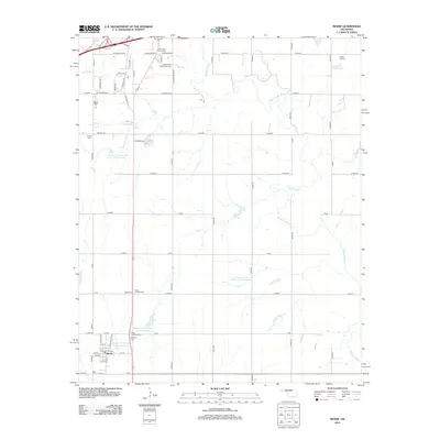
2012 Map of Bessie
USGS Topo · Published 2012About this map
The settlement of Bessie anchors this Custer County landscape, characterized by the winding path of the Washita River and a complex system of water management. The map details numerous reservoirs, including the Boggy Cr Watershed Site 28 Reservoir and S Clinton Laterals Site 102 Reservoir, which speak to the region's agricultural infrastructure and land use in the early 21st century. For genealogists, the survey is remarkably detailed, marking a high concentration of burial sites such as the John Old Crow Cem, Union Hatchett Cem, and the specialized Tuberculosis Sanatorium Cem. These sites, along with the Peace Lutheran Cem and Brethren Cem, provide a clear spatial record of the community's multi-generational history and religious foundations.
Find a feature on this map
73 named features on this map. Tap any name to fly to it.
Don’t see what you’re looking for? This feature index may not catch every label — zoom into the map to look around manually.
Map Details
Editions of this 2012 Bessie Map
This is the sole edition of this map. No revisions or reprints were ever made.
Other maps of this area

1955 · Clinton
USGS Topo · 1:250,000

1956 · Cordell
USGS Topo · 1:62,500

1957 · Clinton
USGS Topo · 1:250,000

1957 · Butler
USGS Topo · 1:62,500

1957 · Clinton
USGS Topo · 1:62,500

1957 · Dill City
USGS Topo · 1:62,500

1976 · Clinton SE
USGS Topo · 1:24,000

1976 · Dill City SE
USGS Topo · 1:24,000

1976 · Clinton SW
USGS Topo · 1:24,000
1976 · Butler SE
USGS Topo · 1:24,000