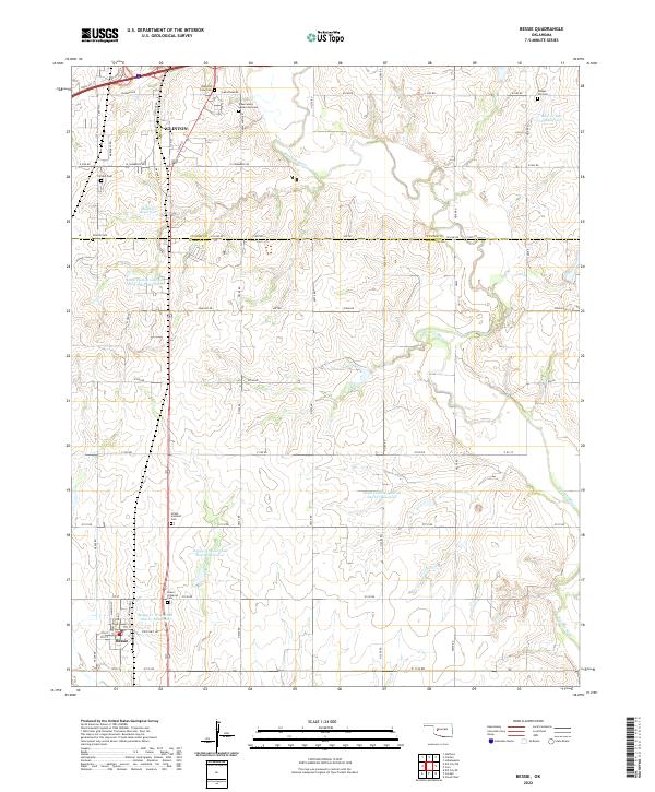
2022 Map of Bessie
USGS Topo · Published 2022About this map
The Washita River meanders across this West-Central Oklahoma landscape, defining the transition between the city of Clinton and the smaller town of Bessie to the south. This area is notable for its high concentration of burial grounds, providing a significant resource for genealogists. Sites such as the John Old Crow Cem, Union-Hatchett Cem, and the uniquely named Tuberculosis Sanatorium Cem are located throughout the townships. The terrain is marked by a sophisticated water management network, featuring numerous catchment areas including the Boggy Cr Watershed Site 27 Reservoir and the South Clinton Laterals Site 102 Reservoir. These engineered landmarks, alongside the Peace Lutheran Cem and Schultz Cem, reflect a landscape deeply shaped by both its agricultural necessity and its community heritage.
Find a feature on this map
72 named features on this map. Tap any name to fly to it.
Don’t see what you’re looking for? This feature index may not catch every label — zoom into the map to look around manually.
Map Details
Editions of this 2022 Bessie Map
This is the sole edition of this map. No revisions or reprints were ever made.
Other maps of this area

1955 · Clinton
USGS Topo · 1:250,000

1956 · Cordell
USGS Topo · 1:62,500

1957 · Clinton
USGS Topo · 1:250,000

1957 · Butler
USGS Topo · 1:62,500

1957 · Clinton
USGS Topo · 1:62,500

1957 · Dill City
USGS Topo · 1:62,500

1976 · Clinton SE
USGS Topo · 1:24,000

1976 · Dill City SE
USGS Topo · 1:24,000

1976 · Clinton SW
USGS Topo · 1:24,000
1976 · Butler SE
USGS Topo · 1:24,000