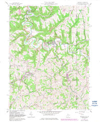
1959 Map of Bethany
USGS Topo · Published 1982About this map
Bethany College and its surroundings anchor this 1959 survey of the West Virginia-Pennsylvania borderlands. The landscape is defined by the winding course of Buffalo Creek, which carves through steep ridges like McAdoo Ridge and Apple Pie Ridge. The map highlights the historical significance of the region, specifically through the Alexander Campbell Mansion and the religious roots of the area evidenced by Stone Chapel Ch. To the south, West Liberty and West Liberty State College represent another key educational hub. The transition from agricultural valley life to industrial extraction is visible in several Mines and a Tipple Mine located near the village of Bethany. Local genealogists will find value in family-named landmarks like Cox Cem and the small settlements of McKinleyville and Frogtown, while the inclusion of the Castleman Run Public Fishing Area and Bellview Campground speaks to the region's recreational character by the late 1950s.
Find a feature on this map
80 named features on this map. Tap any name to fly to it.
Don’t see what you’re looking for? This feature index may not catch every label — zoom into the map to look around manually.
Map Details
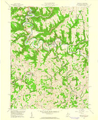
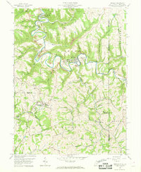
Editions of this 1959 Bethany Map
3 editions found
Other maps of this area

1902 · Wheeling
USGS Topo · 1:62,500

1904 · Steubenville
USGS Topo · 1:62,500

1904 · Burgettstown
USGS Topo · 1:62,500

1906 · Burgettstown
USGS Topo · 1:62,500

1907 · Claysville
USGS Topo · 1:62,500

1935 · Wheeling
USGS Topo · 1:62,500

1935 · Steubenville
USGS Topo · 1:62,500

1942 · Wheeling
USGS Topo · 1:62,500

1942 · Steubenville
USGS Topo · 1:62,500

1951 · Canton
USGS Topo · 1:250,000