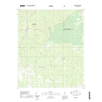
2021 Map of Betheden
USGS Topo · Published 2021About this map
Betheden and the surrounding Winston County woodlands are defined by a network of rural settlements and family cemeteries that mark the local heritage. This landscape is largely preserved within the Tombigbee National Forest and the Sam D Hamilton Noxubee National Wildlife Refuge, where the terrain is drained by watercourses like Nanih Waiya Cr and Yellow Cr.
Find a feature on this map
55 named features on this map. Tap any name to fly to it.
Don’t see what you’re looking for? This feature index may not catch every label — zoom into the map to look around manually.
Map Details
Editions of this 2021 Betheden Map
This is the sole edition of this map. No revisions or reprints were ever made.
Other maps of this area

1953 · West Point
USGS Topo · 1:250,000

1958 · West Point
USGS Topo · 1:250,000

1963 · West Point
USGS Topo · 1:250,000

1965 · Bluff Lake
USGS Topo · 1:24,000

1965 · Bradley
USGS Topo · 1:24,000

1972 · Louisville North
USGS Topo · 1:24,000
1972 · Louisville South
USGS Topo · 1:24,000

1972 · Sturgis
USGS Topo · 1:24,000
1973 · Boon
USGS Topo · 1:24,000
1973 · Fearns Springs
USGS Topo · 1:24,000