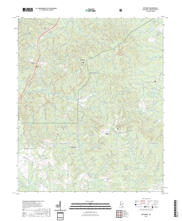
2024 Map of Betheden
USGS Topo · Published 2024About this map
Webster and Betheden anchor this rural Winston County landscape, where family history is deeply rooted in a network of small cemeteries and country churches. The map documents the interface between managed conservation lands and local settlements, with the Tombigbee National Forest and Sam D Hamilton-Noxubee National Wildlife Refuge protecting large tracts of the drainage basins for Jones Creek and Nanih Waiya Creek. For genealogists, the map provides precise locations for historically significant sites such as the Antioch Baptist Church Cem and the Betheden Eden Lutheran Church-Cem. The drainage patterns of Mill Creek and Yellow Creek dictate the winding routes of local roads like Brooksville Rd and Livingston Rd, illustrating how the terrain has historically shaped the community layout of Millcreek and its neighbors.
Find a feature on this map
61 named features on this map. Tap any name to fly to it.
Don’t see what you’re looking for? This feature index may not catch every label — zoom into the map to look around manually.
Map Details
Editions of this 2024 Betheden Map
This is the sole edition of this map. No revisions or reprints were ever made.
Other maps of this area

1953 · West Point
USGS Topo · 1:250,000

1958 · West Point
USGS Topo · 1:250,000

1963 · West Point
USGS Topo · 1:250,000

1965 · Bluff Lake
USGS Topo · 1:24,000

1965 · Bradley
USGS Topo · 1:24,000

1972 · Louisville North
USGS Topo · 1:24,000
1972 · Louisville South
USGS Topo · 1:24,000

1972 · Sturgis
USGS Topo · 1:24,000
1973 · Boon
USGS Topo · 1:24,000
1973 · Fearns Springs
USGS Topo · 1:24,000