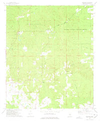
1973 Map of Betheden
USGS Topo · Published 1975About this map
The Tombigbee National Forest and Noxubee National Wildlife Refuge converge in this 1970s landscape, illustrating a region defined by federal land conservation and small rural communities. The tiny settlement of Betheden sits near a prominent lookout tower, while the small hamlet of Webster is situated to the west, near a Webster Cem and several local sandpits. The map reveals a dense network of country churches, including Antioch Ch, Liberty Ch, and two separate Mt Pleasant congregations, which served as the primary social anchors for the dispersed farming and timber families of Winston County.
Find a feature on this map
31 named features on this map. Tap any name to fly to it.
Don’t see what you’re looking for? This feature index may not catch every label — zoom into the map to look around manually.
Map Details
Editions of this 1973 Betheden Map
This is the sole edition of this map. No revisions or reprints were ever made.
Other maps of this area

1953 · West Point
USGS Topo · 1:250,000

1958 · West Point
USGS Topo · 1:250,000

1963 · West Point
USGS Topo · 1:250,000

1965 · Bluff Lake
USGS Topo · 1:24,000

1965 · Bradley
USGS Topo · 1:24,000

1972 · Louisville North
USGS Topo · 1:24,000
1972 · Louisville South
USGS Topo · 1:24,000

1972 · Sturgis
USGS Topo · 1:24,000
1973 · Boon
USGS Topo · 1:24,000
1973 · Fearns Springs
USGS Topo · 1:24,000