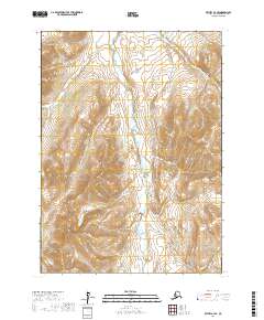
2017 Map of Bethel A-4 SE
USGS Topo · Published 2017About this map
The Eek River meanders through this portion of the Bethel Census Area, serving as the primary drainage for the surrounding terrain. This remote landscape is defined by its water systems, including the headwaters of Kapon Cr in the northern reaches and the southern confluence of Rainy Cr and Arsenic Cr. Unlike maps of developed regions, this survey focuses entirely on the natural hydrography and elevation, showing no modern infrastructure or settlements. The drainage patterns of these creeks into the main river channel provide a clear view of the regional topography, emphasizing the role of these waterways in shaping the Alaskan interior.
Find a feature on this map
8 named features on this map. Tap any name to fly to it.
Don’t see what you’re looking for? This feature index may not catch every label — zoom into the map to look around manually.
Map Details
Editions of this 2017 Bethel A-4 SE Map
This is the sole edition of this map. No revisions or reprints were ever made.
Other maps of this area

1950 · Bethel
USGS Topo · 1:250,000

1951 · Goodnews
USGS Topo · 1:250,000

1954 · Bethel A-4
USGS Topo · 1:63,360

1954 · Goodnews D-4
USGS Topo · 1:63,360

1979 · Bethel A-3
USGS Topo · 1:63,360

1979 · Goodnews Bay D-3
USGS Topo · 1:63,360

1979 · Goodnews Bay
USGS Topo · 1:250,000

1980 · Bethel
USGS Topo · 1:250,000
2017 · Bethel A-4 NE
USGS Topo · 1:25,000
2017 · Bethel A-4 NW
USGS Topo · 1:25,000