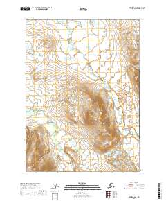
2017 Map of Bethel A-4 NE
USGS Topo · Published 2017About this map
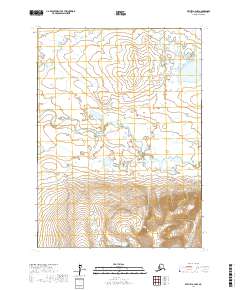
Breast Mtn dominates the central landscape of this wilderness area near Bethel, where the elevation rises sharply from the surrounding river plains. The terrain is defined by the winding course of the Kethluk River as it moves through the northern sections of the map, while the Eek River and its tributary, Kapon Cr, traverse the southern reaches. This 2017 survey by the U.S. Geological Survey illustrates the complex drainage patterns typical of the region, featuring the prominent Eek Lake in the northwest corner. The map provides a clear look at the topographic relief of the mountain and the intricate waterways that have shaped this portion of the Alaska landscape, serving as a primary record of the natural geography within the t1n r63w and t2n r63w townships.
Find a feature on this map
9 named features on this map. Tap any name to fly to it.
Don’t see what you’re looking for? This feature index may not catch every label — zoom into the map to look around manually.
Map Details
Editions of this 2017 Bethel A-4 NE Map
This is the sole edition of this map. No revisions or reprints were ever made.
Other maps of this area

1950 · Bethel
USGS Topo · 1:250,000

1954 · Bethel A-4
USGS Topo · 1:63,360

1954 · Bethel B-3
USGS Topo · 1:63,360

1954 · Bethel B-4
USGS Topo · 1:63,360

1979 · Bethel A-3
USGS Topo · 1:63,360

1980 · Bethel
USGS Topo · 1:250,000
2017 · Bethel B-4 SW
USGS Topo · 1:25,000
2017 · Bethel B-4 SE
USGS Topo · 1:25,000
2017 · Bethel A-4 SE
USGS Topo · 1:25,000
2017 · Bethel A-4 NW
USGS Topo · 1:25,000