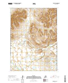
2017 Map of Bethel B-4 SE
USGS Topo · Published 2017About this map
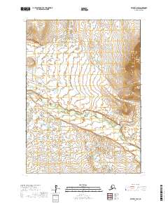
Breast Mtn dominates the northern uplands of this landscape, serving as a prominent landmark above a complex network of glacial and alluvial features. This 2017 survey by the U.S. Geological Survey illustrates the transition from high-relief terrain to the water-rich lowlands of the Yukon-Kuskokwim Delta region. In the southern half of the map, the Kwethluk River winds through a dense field of thermokarst lakes and wetlands, demonstrating the shifting hydrological patterns characteristic of the Alaskan interior. The drainages of Crooked Creek and Fork Cr carve distinct paths through the hills, providing critical drainage for the seasonal snowmelt. The absence of permanent structures or roads underscores the wilderness character of this area, where land use is defined by traditional seasonal travel and subsistence activities rather than fixed settlements.
Find a feature on this map
8 named features on this map. Tap any name to fly to it.
Don’t see what you’re looking for? This feature index may not catch every label — zoom into the map to look around manually.
Map Details
Editions of this 2017 Bethel B-4 SE Map
This is the sole edition of this map. No revisions or reprints were ever made.
Other maps of this area

1950 · Bethel
USGS Topo · 1:250,000

1954 · Bethel A-4
USGS Topo · 1:63,360

1954 · Bethel B-3
USGS Topo · 1:63,360

1954 · Bethel B-4
USGS Topo · 1:63,360

1979 · Bethel A-3
USGS Topo · 1:63,360

1980 · Bethel
USGS Topo · 1:250,000
2017 · Bethel A-4 NE
USGS Topo · 1:25,000
2017 · Bethel B-4 NW
USGS Topo · 1:25,000
2017 · Bethel B-4 NE
USGS Topo · 1:25,000
2017 · Bethel B-4 SW
USGS Topo · 1:25,000