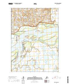
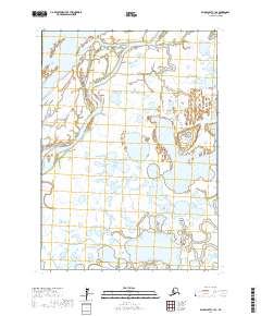
2017 Map of Bethel C-8 NW
USGS Topo · Published 2017About this map
Napakiak sits at a prominent bend in the Kuskokwim River, its local infrastructure defined by the water and the tundra. The settlement is connected by a modest network of local routes including Lagoon Road and Dump Road, which lead out from the community center toward the riverbanks and necessary utility areas. This landscape is a complex of wetlands and shifting river channels, where the Napakiak Airport serves as a critical link between this remote community and the wider region of the Bethel Census Area. The mapping details a specific moment in the river's geomorphology, showing the proximity of the village to the eroding banks of the Kuskokwim, a central concern for the residents who depend on the waterway for transportation and subsistence.
Find a feature on this map
11 named features on this map. Tap any name to fly to it.
Don’t see what you’re looking for? This feature index may not catch every label — zoom into the map to look around manually.
Map Details
Editions of this 2017 Bethel C-8 NW Map
This is the sole edition of this map. No revisions or reprints were ever made.
Other maps of this area

1950 · Bethel
USGS Topo · 1:250,000

1951 · Baird Inlet
USGS Topo · 1:250,000

1954 · Bethel D-8
USGS Topo · 1:63,360

1954 · Bethel C-8
USGS Topo · 1:63,360

1954 · Baird Inlet
USGS Topo · 1:250,000
1954 · Baird Inlet C-1
USGS Topo · 1:63,360
1954 · Baird Inlet D-1
USGS Topo · 1:63,360

1980 · Bethel
USGS Topo · 1:250,000
2017 · Baird Inlet C-1 NE
USGS Topo · 1:25,000
2017 · Baird Inlet C-1 SE
USGS Topo · 1:25,000