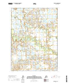
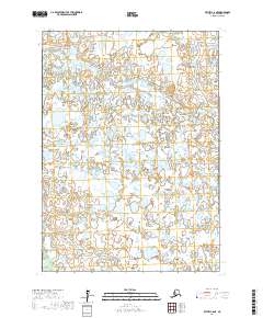
2017 Map of Bethel D-6 SE
USGS Topo · Published 2017About this map
The Kisaralik River meanders across the northern reaches of this landscape within the Bethel Census Area. The terrain is defined by an intricate network of aquatic systems, where the Kasigluk River winds through the central portion of the quadrangle before giving way to the smaller Columbia Cr in the south. This environment is characterized by thousands of small ponds and interconnected waterways, creating a complex hydrologic pattern typical of the Alaskan interior. The absence of roads or permanent structures on this U.S. Geological Survey sheet underscores the wilderness character of the region, emphasizing the importance of these river corridors for navigation and subsistence. Land divisions across the area are noted by township and range markers, such as t9n r66w, t9n r65w, t8n r67w, and t8n r66w.
Find a feature on this map
7 named features on this map. Tap any name to fly to it.
Don’t see what you’re looking for? This feature index may not catch every label — zoom into the map to look around manually.
Map Details
Editions of this 2017 Bethel D-6 SE Map
This is the sole edition of this map. No revisions or reprints were ever made.
Other maps of this area

1950 · Bethel
USGS Topo · 1:250,000

1954 · Bethel C-6
USGS Topo · 1:63,360

1954 · Bethel C-5
USGS Topo · 1:63,360

1954 · Bethel D-6
USGS Topo · 1:63,360

1954 · Bethel D-5
USGS Topo · 1:63,360

1980 · Bethel
USGS Topo · 1:250,000
2017 · Bethel D-6 SW
USGS Topo · 1:25,000
2017 · Bethel C-6 NW
USGS Topo · 1:25,000
2017 · Bethel D-6 NW
USGS Topo · 1:25,000
2017 · Bethel C-6 NE
USGS Topo · 1:25,000