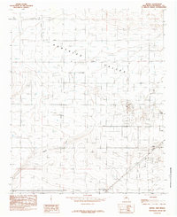
1985 Map of Bethel
USGS Topo · Published 1985About this map
Portales Valley defines the topography of this Roosevelt County landscape, where the flat plains of eastern New Mexico are punctuated by the drainage of Boone Draw. The settlement of Bethel serves as a central landmark in an area characterized by extensive water management, evidenced by the numerous irrigation wells that dot the grid-like sections. This 1980s field survey captures the rural infrastructure of the region, from the Municipal Airport on the eastern edge to the scattered community of Floyd in the north. The presence of Chalk Hill and a gravel pit suggests the underlying geology that supported local road building and industry. Transport and utility networks are prominent, featuring several pipelines and the quiet crossroads at Tinsley Crossing. The map provides a clear look at the intersection of agricultural land use and emerging municipal development near the Portales corporate boundary.
Find a feature on this map
16 named features on this map. Tap any name to fly to it.
Don’t see what you’re looking for? This feature index may not catch every label — zoom into the map to look around manually.
Map Details
Editions of this 1985 Bethel Map
This is the sole edition of this map. No revisions or reprints were ever made.
Other maps of this area

1954 · Clovis
USGS Topo · 1:250,000

1957 · Portair
USGS Topo · 1:62,500

1957 · Melrose
USGS Topo · 1:62,500

1957 · Portales
USGS Topo · 1:62,500

1958 · Clovis
USGS Topo · 1:250,000

1973 · Floyd
USGS Topo · 1:24,000

1973 · Floyd SE
USGS Topo · 1:24,000
1973 · Melrose SE
USGS Topo · 1:24,000
1985 · Portales SE
USGS Topo · 1:24,000
1985 · Delphos
USGS Topo · 1:24,000