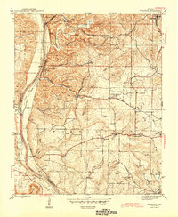
1942 Map of Bethesda
USGS Topo · Published 1945About this map
The White River carves a deep valley along the western boundary of this Independence County landscape, where the Missouri Pacific railroad follows the riverbank past Biltmore Switch and Walls Ferry. In the rugged interior, industrial extraction is evident at the Martin Mines and Mcbride Mines, highlighting the area's mineral-rich geology. This mid-century survey documents a dense network of rural infrastructure, including many neighborhood schools such as O'Neal Sch and Chinquapin Sch, which once served localized farming communities.
Find a feature on this map
71 named features on this map. Tap any name to fly to it.
Don’t see what you’re looking for? This feature index may not catch every label — zoom into the map to look around manually.
Map Details
Editions of this 1942 Bethesda Map
4 editions found
Other maps of this area

1890 · Batesville
USGS Topo · 1:125,000

1891 · Batesville
USGS Topo · 1:125,000

1942 · Bethesda
USGS Topo · 1:24,000

1942 · Jamestown
USGS Topo · 1:31,680

1942 · Almond
USGS Topo · 1:31,680

1942 · Batesville
USGS Topo · 1:31,680

1942 · Mt Pleasant
USGS Topo · 1:31,680

1943 · Sandtown
USGS Topo · 1:24,000

1943 · Batesville
USGS Topo · 1:24,000

1953 · Memphis
USGS Topo · 1:250,000