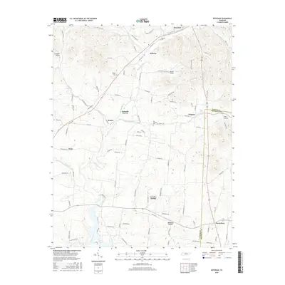
2016 Map of Bethpage
USGS Topo · Published 2016About this map
Bledsoe Creek and its many tributaries, including Dry Fork and Lick Cr, carve through the rolling landscape of eastern Sumner County. This 2016 survey highlights the persistent rural character of settlements like Bethpage, Rogana, and Castalian Springs, where the road network follows the ridges and valleys between Campbell Hollow and Mutton Hollow. The map records several legacy burial sites essential for genealogical research, including Bethpage Cem near the northern boundary and Durham Chapel Cem situated along the central uplands.
Find a feature on this map
98 named features on this map. Tap any name to fly to it.
Don’t see what you’re looking for? This feature index may not catch every label — zoom into the map to look around manually.
Map Details
Editions of this 2016 Bethpage Map
This is the sole edition of this map. No revisions or reprints were ever made.
Other maps of this area

1931 · Lafayette
USGS Topo · 1:62,500

1931 · Adolphus
USGS Topo · 1:62,500

1942 · Gallatin
USGS Topo · 1:100,000

1955 · Bethpage
USGS Topo · 1:24,000

1955 · Laguardo
USGS Topo · 1:24,000

1955 · Hunters Point
USGS Topo · 1:24,000

1955 · Gallatin
USGS Topo · 1:24,000

1956 · Nashville
USGS Topo · 1:250,000

1958 · Westmoreland
USGS Topo · 1:24,000
1958 · Fountain Head
USGS Topo · 1:24,000