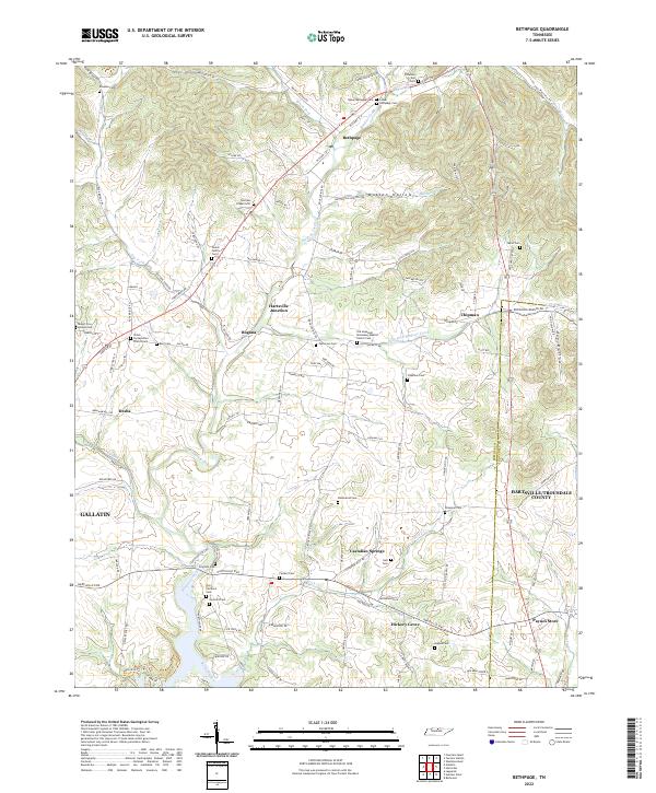
2022 Map of Bethpage
USGS Topo · Published 2022About this map
Bledsoe Creek and its many tributaries, including Lick Cr and the East Fork Bledsoe Creek, define the landscape of this region north of the Gallatin area. The map reveals a dense network of family history markers, evidenced by numerous burial grounds such as Parker Family Cem, Anglea Cem, and the Old Carmack Cem. Small rural centers like Bethpage, Rogana, and Chipman are linked by historic routes including Old Hwy 31E and Rock Bridge Rd.
Find a feature on this map
127 named features on this map. Tap any name to fly to it.
Don’t see what you’re looking for? This feature index may not catch every label — zoom into the map to look around manually.
Map Details
Editions of this 2022 Bethpage Map
This is the sole edition of this map. No revisions or reprints were ever made.
Other maps of this area

1931 · Lafayette
USGS Topo · 1:62,500

1931 · Adolphus
USGS Topo · 1:62,500

1942 · Gallatin
USGS Topo · 1:100,000

1955 · Bethpage
USGS Topo · 1:24,000

1955 · Laguardo
USGS Topo · 1:24,000

1955 · Hunters Point
USGS Topo · 1:24,000

1955 · Gallatin
USGS Topo · 1:24,000

1956 · Nashville
USGS Topo · 1:250,000

1958 · Westmoreland
USGS Topo · 1:24,000
1958 · Fountain Head
USGS Topo · 1:24,000