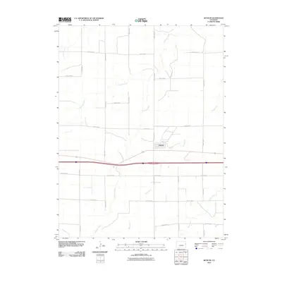
2010 Map of Bethune
USGS Topo · Published 2010About this map
Bethune serves as the central hub for this high plains landscape in Kit Carson County, characterized by a meticulous grid of rural roads and ephemeral waterways. The settlement is situated at the intersection of a major highway and county routes, including County Hwy-40, which provides local access to the surrounding agricultural terrain. The drainage patterns of the region are defined by the meandering paths of Landsman Creek, Sevenmile Creek, and Bonny Creek, which carve subtle variations into the prairie landscape. These watercourses, along with Beaver Creek in the southeast, historically dictated the placement of homesteads and grazing lands. The map illustrates a strictly organized section-line road system, from County Road Z in the north to County Road S in the south, reflecting the enduring legacy of early land surveys and the development of the eastern Colorado plains.
Find a feature on this map
19 named features on this map. Tap any name to fly to it.
Don’t see what you’re looking for? This feature index may not catch every label — zoom into the map to look around manually.
Map Details
Editions of this 2010 Bethune Map
This is the sole edition of this map. No revisions or reprints were ever made.
Other maps of this area

1954 · Limon
USGS Topo · 1:250,000

1957 · Limon
USGS Topo · 1:250,000

1958 · Limon
USGS Topo · 1:250,000

1969 · Alpine Ranch NE
USGS Topo · 1:24,000

1969 · Settlement
USGS Topo · 1:24,000

1969 · Tuttle
USGS Topo · 1:24,000

1969 · Bethune
USGS Topo · 1:24,000

1969 · Burlington
USGS Topo · 1:24,000

1969 · Burlington 3 NW
USGS Topo · 1:24,000

1969 · Stratton
USGS Topo · 1:24,000