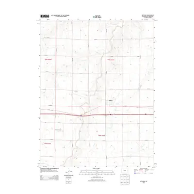
2013 Map of Bethune
USGS Topo · Published 2013About this map
Bethune serves as a central point of this High Plains landscape, situated just north of the junction of Us-24 E and CO Hwy 40. This 2013 survey illustrates a highly organized section-line road network typical of Kit Carson County, where routes like CO Road Z and CO Road 37 define the agricultural grid. Despite the rigid geometry of the roads, the natural drainage patterns of Landsman Creek and Sevenmile Cr carve winding paths across the terrain, influencing the placement of local infrastructure. To the southwest, Hildebrandt Airport stands as a notable landmark of rural aviation, while the presence of Bonny Cr and Beaver Cr highlights the vital role of seasonal waterways in this prairie environment. The map captures the interface between modern transportation corridors and the persistent natural drainage systems that define this part of eastern Colorado.
Find a feature on this map
26 named features on this map. Tap any name to fly to it.
Don’t see what you’re looking for? This feature index may not catch every label — zoom into the map to look around manually.
Map Details
Editions of this 2013 Bethune Map
This is the sole edition of this map. No revisions or reprints were ever made.
Other maps of this area

1954 · Limon
USGS Topo · 1:250,000

1957 · Limon
USGS Topo · 1:250,000

1958 · Limon
USGS Topo · 1:250,000

1969 · Alpine Ranch NE
USGS Topo · 1:24,000

1969 · Settlement
USGS Topo · 1:24,000

1969 · Tuttle
USGS Topo · 1:24,000

1969 · Bethune
USGS Topo · 1:24,000

1969 · Burlington
USGS Topo · 1:24,000

1969 · Burlington 3 NW
USGS Topo · 1:24,000

1969 · Stratton
USGS Topo · 1:24,000