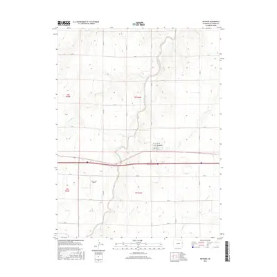
2016 Map of Bethune
USGS Topo · Published 2016About this map
Bethune stands as a centralized hub in the eastern plains of Kit Carson County, organized around a grid that includes Pikes Peak Ave, 1st Ave, and W Third Ave. This 2016 survey illustrates the structured landscape of High Plains agriculture, where a vast network of county roads like Co RD Z and Co RD 40 segments the terrain into precise sections. The natural drainage of the region is defined by the winding paths of Sevenmile Cr and Landsman Creek, which cut across the otherwise orderly rectangular survey lines. To the southwest of the town center, Hildebrandt Airport provides a specialized landmark among the fields. This map documents the persistent layout of rural Colorado, where the intersection of Interstate 70 and local routes dictates the flow of commerce and transport through the prairie.
Find a feature on this map
28 named features on this map. Tap any name to fly to it.
Don’t see what you’re looking for? This feature index may not catch every label — zoom into the map to look around manually.
Map Details
Editions of this 2016 Bethune Map
This is the sole edition of this map. No revisions or reprints were ever made.
Other maps of this area

1954 · Limon
USGS Topo · 1:250,000

1957 · Limon
USGS Topo · 1:250,000

1958 · Limon
USGS Topo · 1:250,000

1969 · Alpine Ranch NE
USGS Topo · 1:24,000

1969 · Settlement
USGS Topo · 1:24,000

1969 · Tuttle
USGS Topo · 1:24,000

1969 · Bethune
USGS Topo · 1:24,000

1969 · Burlington
USGS Topo · 1:24,000

1969 · Burlington 3 NW
USGS Topo · 1:24,000

1969 · Stratton
USGS Topo · 1:24,000