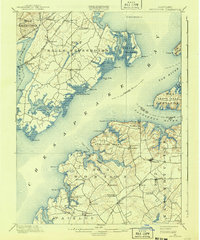
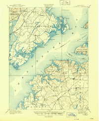
1900 Map of Betterton
USGS Topo · Published 1941About this map
Chesapeake Bay dominates this late-Victorian era survey, illustrating the critical maritime and rail connections of the Upper Bay before the era of modern bridges. The shoreline is punctuated by essential steamboat and shipping infrastructure, including Harris Wharf, Gales Whf., and Buck Neck Landing, which served as vital transit points for the agricultural districts of Stillpond Neck and Worton. Inland, the landscape is defined by the competing routes of the Phila. Balto. & Wash. R.R. and the Baltimore and Ohio R.R., which bypassed the older water-bound settlements to favor rail hubs like Perryman and Bush River. The map captures a high-water mark for bay navigation, documented by the Fishing Battery L.H. and the frequent ferries crossing the Spesutie Narrows. Small inland communities such as Butlertown, Smithville, and Coleman appear as they were at the turn of the century, deeply integrated into this river-and-rail economy.
Find a feature on this map
76 named features on this map. Tap any name to fly to it.
Don’t see what you’re looking for? This feature index may not catch every label — zoom into the map to look around manually.
Map Details
Editions of this 1900 Betterton Map
6 editions found
Other maps of this area

1893 · North Point
USGS Topo · 1:62,500

1893 · Gunpowder
USGS Topo · 1:62,500

1898 · Elkton
USGS Topo · 1:62,500

1898 · Tolchester
USGS Topo · 1:125,000

1899 · Dover
USGS Topo · 1:125,000

1900 · Elkton
USGS Topo · 1:62,500

1900 · Cecilton
USGS Topo · 1:62,500

1900 · Havre De Grace
USGS Topo · 1:62,500

1900 · Betterton
USGS Topo · 1:62,500

1901 · Belair
USGS Topo · 1:62,500