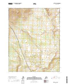
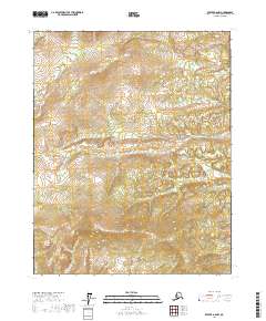
2017 Map of Bettles A-1 NE
USGS Topo · Published 2017About this map
The Alaska Pipeline and the Dalton Highway dominate this section of the Yukon-Koyukuk region, illustrating the critical infrastructure corridor that bisects the Alaskan interior. This map documents the essential logistics route through the remote terrain, showing the close alignment of the road and pipeline as they navigate the elevations and wetland complexes of the interior. The landscape is characterized by a high density of wetlands and significant topographic relief, with several townships—including t16n r13w, t16n r12w, t15n r13w, and t15n r12w—defined by these infrastructure lines. For researchers and surveyors, the map provides a precise account of how these industrial landmarks follow the natural contours of the land at a 1:25,000 scale.
Find a feature on this map
6 named features on this map. Tap any name to fly to it.
Don’t see what you’re looking for? This feature index may not catch every label — zoom into the map to look around manually.
Map Details
Editions of this 2017 Bettles A-1 NE Map
This is the sole edition of this map. No revisions or reprints were ever made.
Other maps of this area

1951 · Bettles
USGS Topo · 1:250,000

1951 · Beaver
USGS Topo · 1:250,000

1956 · Bettles
USGS Topo · 1:250,000

1956 · Beaver
USGS Topo · 1:250,000

1964 · Beaver
USGS Topo · 1:250,000

1970 · Beaver B-6
USGS Topo · 1:63,360
1970 · Beaver A-6
USGS Topo · 1:63,360
1970 · Bettles B-1
USGS Topo · 1:63,360
1970 · Bettles A-1
USGS Topo · 1:63,360
2017 · Beaver A-6 NW
USGS Topo · 1:25,000