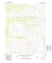
1970 Map of Bettles C-1
USGS Topo · Published 1988About this map
Yukon Flats National Wildlife Refuge defines the eastern edge of this landscape, where the terrain transitions toward the vast interior wetlands of Alaska. The hydrology of the region is dominated by parallel drainage systems, most notably the North Fork Bonanza Creek and South Fork Bonanza Creek, which carve through the high ground before the land descends toward the south. Along the southern boundary, the Kanuti River and Fish Creek snake through the topography, illustrating the complex watershed patterns typical of this subarctic environment. Based on data from 1970, this sheet records a wilderness essentially devoid of permanent roads or settlements, reflecting a period when federal land classifications were being established under the Alaska National Interest Lands Conservation Act.
Find a feature on this map
6 named features on this map. Tap any name to fly to it.
Don’t see what you’re looking for? This feature index may not catch every label — zoom into the map to look around manually.
Map Details
Editions of this 1970 Bettles C-1 Map
2 editions found
Other maps of this area

1951 · Bettles
USGS Topo · 1:250,000

1951 · Beaver
USGS Topo · 1:250,000

1956 · Bettles
USGS Topo · 1:250,000

1956 · Beaver
USGS Topo · 1:250,000

1964 · Beaver
USGS Topo · 1:250,000
1970 · Bettles D-1
USGS Topo · 1:63,360

1970 · Bettles B-2
USGS Topo · 1:63,360
1970 · Beaver C-6
USGS Topo · 1:63,360

1970 · Beaver B-6
USGS Topo · 1:63,360
1970 · Bettles C-1
USGS Topo · 1:63,360