
1970 Map of Bettles B-2
USGS Topo · Published 1973About this map
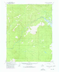
Kanuti River winds extensively through this interior Alaskan landscape, characterized by complex oxbows and marshlands that define the central valley. In the eastern portion of the quadrangle, Caribou Mountain rises as a prominent landmark above the surrounding lowlands. The 1970 aerial survey, published in coordination with the Bureau of Land Management, documents a wilderness largely defined by seasonal access routes. Notable examples include a Winter Road in the northeastern quadrant and a Winter Trail cutting across the northern reaches, indicating the importance of frozen ground for overland transport in this subarctic environment. The lack of permanent structures or towns highlights the region's character as a resource-rich interior corridor primarily utilized for navigation and seasonal passage.
Find a feature on this map
6 named features on this map. Tap any name to fly to it.
Don’t see what you’re looking for? This feature index may not catch every label — zoom into the map to look around manually.
Map Details
Editions of this 1970 Bettles B-2 Map
2 editions found
Other maps of this area

1951 · Bettles
USGS Topo · 1:250,000

1956 · Bettles
USGS Topo · 1:250,000
1970 · Bettles A-3
USGS Topo · 1:63,360
1970 · Bettles B-3
USGS Topo · 1:63,360
1970 · Bettles C-1
USGS Topo · 1:63,360

1970 · Bettles C-2
USGS Topo · 1:63,360
1970 · Bettles B-1
USGS Topo · 1:63,360
1970 · Bettles A-1
USGS Topo · 1:63,360
1970 · Bettles A-2
USGS Topo · 1:63,360
1970 · Bettles C-3
USGS Topo · 1:63,360