
1970 Map of Bettles C-2
USGS Topo · Published 1973About this map
Bonanza Creek and Fish Creek dominate this 1970 landscape, winding through a wilderness where human presence is marked only by ephemeral seasonal paths. The terrain is defined by low-lying wetlands and the significant elevation of Nanuk, which stands as a prominent landmark in the southern reaches. This remote stretch of the Yukon-Koyukuk region reflects a pre-development era in Alaska, where movement relied heavily on the cold-weather network of the Winter Road and Winter Trail. These routes were essential for navigating the interior's saturated ground, providing the only reliable ground access before modern infrastructure. The map captures an era of transition as the Bureau of Land Management began predetermining land lines across previously unsurveyed territories, marking the first steps of formal geographic organization in this subarctic frontier.
Find a feature on this map
6 named features on this map. Tap any name to fly to it.
Don’t see what you’re looking for? This feature index may not catch every label — zoom into the map to look around manually.
Map Details
Editions of this 1970 Bettles C-2 Map
2 editions found
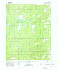
Other maps of this area

1951 · Bettles
USGS Topo · 1:250,000

1956 · Bettles
USGS Topo · 1:250,000
1970 · Bettles D-1
USGS Topo · 1:63,360

1970 · Bettles B-2
USGS Topo · 1:63,360
1970 · Bettles B-3
USGS Topo · 1:63,360
1970 · Bettles C-1
USGS Topo · 1:63,360

1970 · Bettles D-3
USGS Topo · 1:63,360

1970 · Bettles D-2
USGS Topo · 1:63,360
1970 · Bettles B-1
USGS Topo · 1:63,360
1970 · Bettles C-3
USGS Topo · 1:63,360