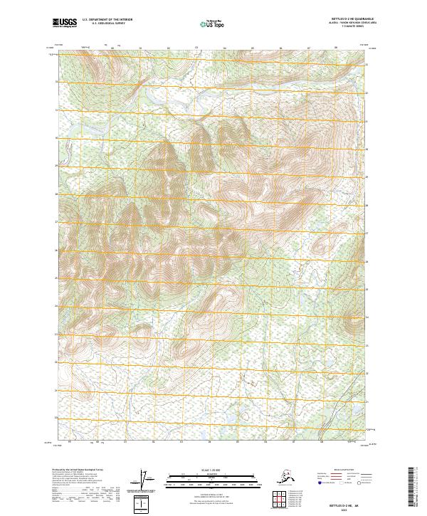
2023 Map of Bettles D-2 NE
USGS Topo · Published 2023About this map
The Dalton Highway Alaska Pipeline corridor cuts through this portion of the Alaska-Yukon-Koyukuk Census Area, marking the primary human footprint in a landscape defined by significant water systems. The Alaska Pipeline itself runs parallel to the highway in the southeastern corner, crossing the Jim River just as it enters the quadrangle. This infrastructure provides a stark contrast to the winding path of the South Fork Koyukuk River, which dominates the northern third of the map. Smaller tributaries like Eagle Creek, Hudson Ray Creek, and Anticline Creek drain the surrounding terrain, while the John River makes a brief appearance in the southeast. The survey highlights the intersection of critical energy transport and the vast drainage networks of the interior, illustrating how modern engineering follows the natural contours of the river valleys.
Find a feature on this map
13 named features on this map. Tap any name to fly to it.
Don’t see what you’re looking for? This feature index may not catch every label — zoom into the map to look around manually.
Map Details
Editions of this 2023 Bettles D-2 NE Map
This is the sole edition of this map. No revisions or reprints were ever made.
Other maps of this area

1951 · Bettles
USGS Topo · 1:250,000

1951 · Wiseman
USGS Topo · 1:250,000

1956 · Bettles
USGS Topo · 1:250,000

1956 · Wiseman
USGS Topo · 1:250,000

1964 · Wiseman
USGS Topo · 1:250,000

1970 · Wiseman A-1
USGS Topo · 1:63,360
1970 · Bettles D-1
USGS Topo · 1:63,360

1970 · Wiseman A-2
USGS Topo · 1:63,360

1970 · Bettles D-2
USGS Topo · 1:63,360
2017 · Wiseman A-1 SW
USGS Topo · 1:25,000