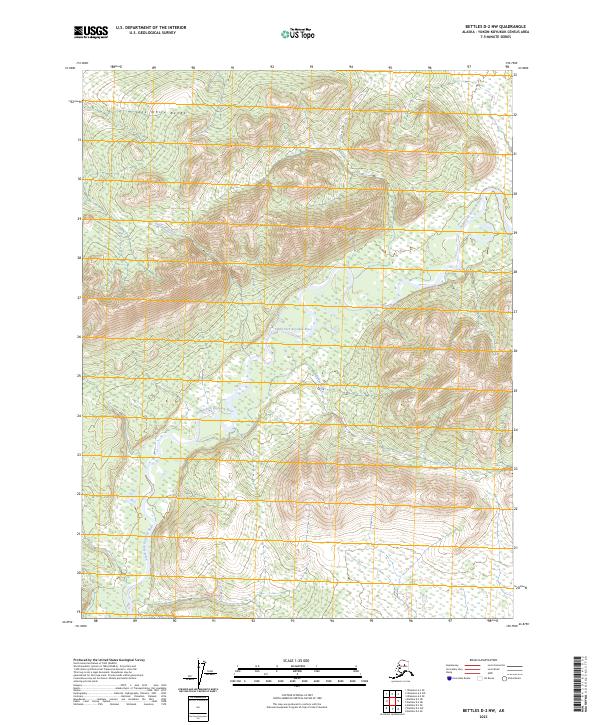
2023 Map of Bettles D-2 NW
USGS Topo · Published 2023About this map
The Jack White Range dominates this landscape in the Yukon-Koyukuk region, where steep ridgelines give way to a complex network of glacial and alluvial drainages. The South Fork Koyukuk River winds through the southwestern portion of the quadrangle, serving as the primary hydrological artery for the surrounding wilderness. Smaller tributaries, including Antelope Creek, Eldorado Creek, and Harris Creek, carve through the high elevations, illustrating the erosional patterns of the Brooks Range foothills. This 2023 survey by the U.S. Geological Survey provides a precise view of the terrain's topography, useful for understanding the seasonal water flow and land-surveying boundaries in this remote Alaskan interior.
Find a feature on this map
9 named features on this map. Tap any name to fly to it.
Don’t see what you’re looking for? This feature index may not catch every label — zoom into the map to look around manually.
Map Details
Editions of this 2023 Bettles D-2 NW Map
This is the sole edition of this map. No revisions or reprints were ever made.
Other maps of this area

1951 · Bettles
USGS Topo · 1:250,000

1951 · Wiseman
USGS Topo · 1:250,000

1956 · Bettles
USGS Topo · 1:250,000

1956 · Wiseman
USGS Topo · 1:250,000

1964 · Wiseman
USGS Topo · 1:250,000

1970 · Wiseman A-3
USGS Topo · 1:63,360

1970 · Wiseman A-2
USGS Topo · 1:63,360

1970 · Bettles D-3
USGS Topo · 1:63,360

1970 · Bettles D-2
USGS Topo · 1:63,360
2016 · Wiseman A-3 SE
USGS Topo · 1:25,000