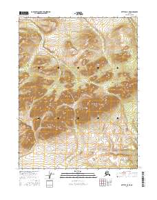
2016 Map of Bettles D-3 NE
USGS Topo · Published 2016About this map
Jack White Range defines the high terrain of this interior Alaskan landscape, a remote section of the Yukon-Koyukuk region. In the northern half of the survey, the headwaters of Hackett Creek and Jack White Creek flow through deep drainages separated by high ridges. To the south, the terrain rises toward the prominent Pope Creek Dome, a significant landmark that anchors the surrounding watershed. The drainage pattern here is defined by Pope Creek, which winds through the central and southeastern portions of the map, and Hunt Creek at the far eastern edge. This 2016 data reflects a landscape largely untouched by infrastructure, where the topography is the primary record of the land. It offers a detailed view of the natural hydrology and land divisions, including t25n r17w and t24n r16w, essential for understanding the geographic orientation of this subarctic wilderness.
Find a feature on this map
10 named features on this map. Tap any name to fly to it.
Don’t see what you’re looking for? This feature index may not catch every label — zoom into the map to look around manually.
Map Details
Editions of this 2016 Bettles D-3 NE Map
This is the sole edition of this map. No revisions or reprints were ever made.
Other maps of this area

1951 · Bettles
USGS Topo · 1:250,000

1951 · Wiseman
USGS Topo · 1:250,000

1956 · Bettles
USGS Topo · 1:250,000

1956 · Wiseman
USGS Topo · 1:250,000

1964 · Wiseman
USGS Topo · 1:250,000

1970 · Wiseman A-3
USGS Topo · 1:63,360

1970 · Wiseman A-2
USGS Topo · 1:63,360

1970 · Bettles D-3
USGS Topo · 1:63,360

1970 · Bettles D-2
USGS Topo · 1:63,360
2016 · Wiseman A-3 SW
USGS Topo · 1:25,000