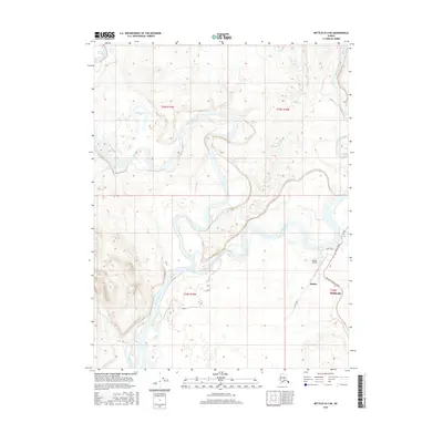
2016 Map of Bettles D-4 NE
USGS Topo · Published 2016About this map
The confluence of the John River and the Koyukuk River dominates this 2016 survey of the Alaskan interior, showing a landscape defined by shifting waterways and seasonal drainage. The twin settlements of Bettles and Evansville sit on the eastern bank of the Koyukuk, serving as a critical aviation hub for this region. The Bettles Airport is the primary infrastructure here, supported by a modest network of local routes including Airport Road, River Road, and the Vor Lake Access Road.
Find a feature on this map
18 named features on this map. Tap any name to fly to it.
Don’t see what you’re looking for? This feature index may not catch every label — zoom into the map to look around manually.
Map Details
Editions of this 2016 Bettles D-4 NE Map
This is the sole edition of this map. No revisions or reprints were ever made.
Other maps of this area

1951 · Bettles
USGS Topo · 1:250,000

1951 · Wiseman
USGS Topo · 1:250,000

1956 · Bettles
USGS Topo · 1:250,000

1956 · Wiseman
USGS Topo · 1:250,000

1964 · Wiseman
USGS Topo · 1:250,000

1970 · Bettles D-4
USGS Topo · 1:63,360

1970 · Wiseman A-4
USGS Topo · 1:63,360

1970 · Wiseman A-3
USGS Topo · 1:63,360

1970 · Bettles D-3
USGS Topo · 1:63,360
2016 · Wiseman A-4 SW
USGS Topo · 1:25,000