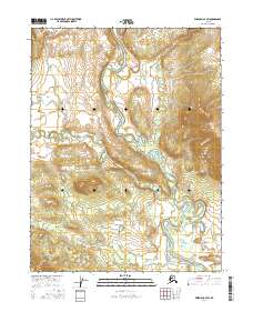
2016 Map of Wiseman A-4 SW
USGS Topo · Published 2016About this map
The John River dominates this interior Alaskan landscape, carving a wide valley through the Yukon-Koyukuk region. Its braided channels and significant meanders are captured here in detail, particularly where it meets major tributaries like the Malamute Fork. The topography shows a stark contrast between the low-lying wetlands adjacent to the riverbanks and the rising elevations that define the watershed boundaries. Along the eastern edge of the quadrangle, Timber Cr flows southward through more confined terrain before its eventual confluence with the main river system. In the southeast corner, the drainage of Ninemile Cr indicates the complex network of smaller waterways that feed this remote river basin, while the township and range lines of t26n r20w and t26n r19w provide the primary human-imposed grid over the wilderness.
Find a feature on this map
10 named features on this map. Tap any name to fly to it.
Don’t see what you’re looking for? This feature index may not catch every label — zoom into the map to look around manually.
Map Details
Editions of this 2016 Wiseman A-4 SW Map
This is the sole edition of this map. No revisions or reprints were ever made.
Other maps of this area

1951 · Bettles
USGS Topo · 1:250,000

1951 · Wiseman
USGS Topo · 1:250,000

1956 · Bettles
USGS Topo · 1:250,000

1956 · Wiseman
USGS Topo · 1:250,000

1964 · Wiseman
USGS Topo · 1:250,000

1970 · Bettles D-4
USGS Topo · 1:63,360

1970 · Wiseman A-4
USGS Topo · 1:63,360

1970 · Wiseman A-5
USGS Topo · 1:63,360
1970 · Bettles D-5
USGS Topo · 1:63,360
2016 · Wiseman A-4 NW
USGS Topo · 1:25,000