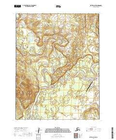
2019 Map of Bettles D-4 NE
USGS Topo · Published 2019About this map
The Koyukuk River and John River converge in this remote Arctic landscape, centering on the bush pilot hub of Bettles. As a vital transportation node for the Yukon-Koyukuk region, the settlement is anchored by the Bettles Airport and a small network of local tracks including Old Dump Road and VOR Lake Access Road. The map documents the intricate hydrology of the valley, where Wild River and Jane Creek meander through the floodplain.
Find a feature on this map
19 named features on this map. Tap any name to fly to it.
Don’t see what you’re looking for? This feature index may not catch every label — zoom into the map to look around manually.
Map Details
Editions of this 2019 Bettles D-4 NE Map
This is the sole edition of this map. No revisions or reprints were ever made.
Other maps of this area

1951 · Bettles
USGS Topo · 1:250,000

1951 · Wiseman
USGS Topo · 1:250,000

1956 · Bettles
USGS Topo · 1:250,000

1956 · Wiseman
USGS Topo · 1:250,000

1964 · Wiseman
USGS Topo · 1:250,000

1970 · Bettles D-4
USGS Topo · 1:63,360

1970 · Wiseman A-4
USGS Topo · 1:63,360

1970 · Wiseman A-3
USGS Topo · 1:63,360

1970 · Bettles D-3
USGS Topo · 1:63,360
2016 · Wiseman A-4 SW
USGS Topo · 1:25,000