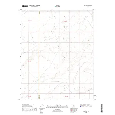
2018 Map of Betty Well
USGS Topo · Published 2018About this map
Betty Well sits at the heart of this high-desert landscape within the Fort Defiance Agency, marking a vital water point in an arid expanse defined by expansive plateaus and drainage basins. The boundary between Navajo Co and Apache Co bisects the terrain vertically, providing a clear reference for researchers tracing land ownership or jurisdictional history in this portion of the Southwest. While human habitation is sparse, the map documents a network of desert routes such as Tanner Springs Rd and N 9003, which likely served as the primary conduits for ranching and local travel. The detailed contour lines and township-and-range markings, including t22n r24e, provide a precise look at the drainage patterns and topography surrounding the central well.
Find a feature on this map
10 named features on this map. Tap any name to fly to it.
Don’t see what you’re looking for? This feature index may not catch every label — zoom into the map to look around manually.
Map Details
Editions of this 2018 Betty Well Map
This is the sole edition of this map. No revisions or reprints were ever made.
Other maps of this area

1886 · Fort Defiance
USGS Topo · 1:250,000

1892 · Fort Defiance
USGS Topo · 1:250,000

1954 · Gallup
USGS Topo · 1:250,000

1958 · Gallup
USGS Topo · 1:250,000

1959 · Gallup
USGS Topo · 1:250,000

1962 · Gallup
USGS Topo · 1:250,000

1967 · Gallup
USGS Topo · 1:250,000
1972 · Pilot Rock
USGS Topo · 1:24,000
1972 · Tanner Springs
USGS Topo · 1:24,000
1972 · North Mill Well
USGS Topo · 1:24,000