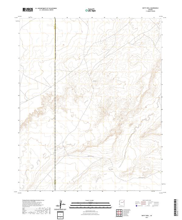
2021 Map of Betty Well
USGS Topo · Published 2021About this map
Betty Well sits at the heart of this high-plateau landscape along the boundary of Navajo and Apache counties. This 2021 survey reveals a territory primarily defined by its topographic contours and essential water resources, reflecting the enduring ranching and pastoral traditions of northeastern Arizona. The sparse infrastructure is anchored by Tanner Springs Rd, which traverses the southern portion of the quadrangle, while N 9003 provides a secondary route through the western hills. The map captures the geometric precision of the Public Land Survey System, showing the township and range lines of T22N R23E and T22N R24E as they intersect the county line, providing a modern baseline for understanding land tenure in this portion of the Painted Desert region.
Find a feature on this map
4 named features on this map. Tap any name to fly to it.
Don’t see what you’re looking for? This feature index may not catch every label — zoom into the map to look around manually.
Map Details
Editions of this 2021 Betty Well Map
This is the sole edition of this map. No revisions or reprints were ever made.
Other maps of this area

1886 · Fort Defiance
USGS Topo · 1:250,000

1892 · Fort Defiance
USGS Topo · 1:250,000

1954 · Gallup
USGS Topo · 1:250,000

1958 · Gallup
USGS Topo · 1:250,000

1959 · Gallup
USGS Topo · 1:250,000

1962 · Gallup
USGS Topo · 1:250,000

1967 · Gallup
USGS Topo · 1:250,000
1972 · Pilot Rock
USGS Topo · 1:24,000
1972 · Tanner Springs
USGS Topo · 1:24,000
1972 · North Mill Well
USGS Topo · 1:24,000