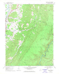
1969 Map of Beverly East
USGS Topo · Published 1971About this map
Beverly and the winding Tygart Valley River anchor the western edge of this West Virginia landscape, where early industrial and religious life is clearly marked. The map documents a period of transition, showing the Western Maryland railroad tracking alongside the river while deep in the Monongahela National Forest, several rail junctions emerge. Local history is preserved in the location of Mt Vernon Ch, Mt Carmel Ch, and various rural settlements like Hazelwood.
Find a feature on this map
62 named features on this map. Tap any name to fly to it.
Don’t see what you’re looking for? This feature index may not catch every label — zoom into the map to look around manually.
Map Details
Editions of this 1969 Beverly East Map
3 editions found
Other maps of this area

1889 · Beverly
USGS Topo · 1:125,000

1892 · Beverly
USGS Topo · 1:125,000

1909 · Elkins
USGS Topo · 1:62,500

1922 · Horton
USGS Topo · 1:48,000

1922 · Spruce Knob
USGS Topo · 1:48,000

1922 · Durbin
USGS Topo · 1:48,000

1924 · Durbin
USGS Topo · 1:62,500

1924 · Horton
USGS Topo · 1:62,500

1924 · Spruce Knob
USGS Topo · 1:62,500

1949 · Charlottesville
USGS Topo · 1:250,000