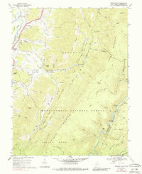
1969 Map of Beverly East
USGS Topo · Published 1987About this map
Beverly and Hazelwood sit along the western edge of this 1969 topographic survey, where the valley floor transitions into the massive ridgelines of the Monongahela National Forest. The landscape is dominated by the parallel spines of Cheat Mountain and Shavers Mountain, deeply etched by drainage systems like Files Creek and Shavers Fork. Notable rural landmarks include Mt Vernon Ch, Mt Carmel Ch, and the riverside site of Camp Pioneer.
Find a feature on this map
61 named features on this map. Tap any name to fly to it.
Don’t see what you’re looking for? This feature index may not catch every label — zoom into the map to look around manually.
Map Details
Editions of this 1969 Beverly East Map
3 editions found
Other maps of this area

1889 · Beverly
USGS Topo · 1:125,000

1892 · Beverly
USGS Topo · 1:125,000

1909 · Elkins
USGS Topo · 1:62,500

1922 · Horton
USGS Topo · 1:48,000

1922 · Spruce Knob
USGS Topo · 1:48,000

1922 · Durbin
USGS Topo · 1:48,000

1924 · Durbin
USGS Topo · 1:62,500

1924 · Horton
USGS Topo · 1:62,500

1924 · Spruce Knob
USGS Topo · 1:62,500

1949 · Charlottesville
USGS Topo · 1:250,000