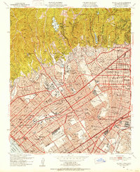
1950 Map of Beverly Hills
USGS Topo · Published 1952About this map
The Santa Monica Mountains drop sharply into the residential and commercial heart of the Westside in the years following World War II. The sprawling grounds of the Univ of California at Los Angeles and the Soldiers Home define the central landscape, showing a period of institutional growth between Westwood Village and Sawtelle. Transit patterns are dominated by the Pacific Electric railway and the established grid of Sunset Blvd and Wilshire Blvd. Along the coast, Santa Monica is shown with its Municipal Pier and Woodlawn Cemetery, while the aviation industry is represented by the Municipal Airport (Clover Field). To the north, the canyons and ridges of Bel Air and Beverly Glen contrast with the dense urbanization of Beverly Hills and West Hollywood, illustrating the geographic divide between the upland estates and the burgeoning lowland neighborhoods.
Find a feature on this map
129 named features on this map. Tap any name to fly to it.
Don’t see what you’re looking for? This feature index may not catch every label — zoom into the map to look around manually.
Map Details
Editions of this 1950 Beverly Hills Map
4 editions found
Other maps of this area

1894 · Los Angeles
USGS Topo · 1:62,500

1896 · Redondo
USGS Topo · 1:62,500

1896 · Santa Monica
USGS Topo · 1:62,500

1898 · Santa Monica
USGS Topo · 1:62,500

1900 · Los Angeles
USGS Topo · 1:62,500

1901 · Southern California Sheet No. 1
USGS Topo · 1:250,000

1902 · Santa Monica
USGS Topo · 1:62,500

1903 · Calabasas
USGS Topo · 1:62,500

1903 · Camulos
USGS Topo · 1:125,000

1904 · Southern California Sheet No. 1
USGS Topo · 1:250,000