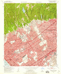
1950 Map of Beverly Hills
USGS Topo · Published 1959About this map
The Golden Age of Hollywood’s physical footprint is etched into this survey, which highlights the massive operations of Hal Roach Studios, Selznick Studios, and M G M Studios near Culver City. The landscape transitions from the residential grids of Beverly Hills and Westwood Village to the steep canyons of the Santa Monica Mountains, where Stone Canyon Res and Franklin Canyon Res sit tucked into the ridges. In West Los Angeles, the sprawling grounds of the Soldiers Home and the University of California at Los Angeles dominate the local geography.
Find a feature on this map
135 named features on this map. Tap any name to fly to it.
Don’t see what you’re looking for? This feature index may not catch every label — zoom into the map to look around manually.
Map Details
Editions of this 1950 Beverly Hills Map
4 editions found
Other maps of this area

1894 · Los Angeles
USGS Topo · 1:62,500

1896 · Redondo
USGS Topo · 1:62,500

1896 · Santa Monica
USGS Topo · 1:62,500

1898 · Santa Monica
USGS Topo · 1:62,500

1900 · Los Angeles
USGS Topo · 1:62,500

1901 · Southern California Sheet No. 1
USGS Topo · 1:250,000

1902 · Santa Monica
USGS Topo · 1:62,500

1903 · Calabasas
USGS Topo · 1:62,500

1903 · Camulos
USGS Topo · 1:125,000

1904 · Southern California Sheet No. 1
USGS Topo · 1:250,000