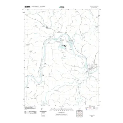
2010 Map of Beverly
USGS Topo · Published 2010About this map
The Muskingum River winds through the heart of this landscape, defining the industrial and agricultural character of the valley between Beverly and Waterford. The map reveals a complex modern industrial footprint centered on the Muskingum River Fly Ash Reservoir and its associated impoundments, including the Lower Reservoir Bottom Ash Dam. This infrastructure is connected by the AEP Belt Line, which cuts across the terrain to the north of Hayward.
Find a feature on this map
113 named features on this map. Tap any name to fly to it.
Don’t see what you’re looking for? This feature index may not catch every label — zoom into the map to look around manually.
Map Details
Editions of this 2010 Beverly Map
This is the sole edition of this map. No revisions or reprints were ever made.
Other maps of this area

1902 · Parkersburg
USGS Topo · 1:62,500

1904 · Parkersburg
USGS Topo · 1:62,500

1904 · Chesterhill
USGS Topo · 1:62,500

1906 · Chesterhill
USGS Topo · 1:62,500

1909 · Caldwell
USGS Topo · 1:62,500

1910 · Mc Connelsville
USGS Topo · 1:62,500

1912 · Caldwell
USGS Topo · 1:62,500

1949 · Clarksburg
USGS Topo · 1:250,000

1956 · Clarksburg
USGS Topo · 1:250,000

1960 · Watertown
USGS Topo · 1:24,000