
1960 Map of Watertown
USGS Topo · Published 1961About this map
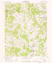
Wolf Creek and its many winding tributaries, including the West Branch and South Fork, define the agrarian landscape of Washington County at the dawn of the 1960s. The map reveals an area deeply tied to its natural resources, with numerous Oil Wells and Gas Wells scattered throughout the townships of Palmer, Windsor, and Watertown. Small rural centers such as Barlow and Vincent serve as local hubs, anchored by community institutions like the Barlow-Vincent School and St Ambrose Church.
Find a feature on this map
39 named features on this map. Tap any name to fly to it.
Don’t see what you’re looking for? This feature index may not catch every label — zoom into the map to look around manually.
Map Details
Editions of this 1960 Watertown Map
3 editions found
Other maps of this area

1902 · Parkersburg
USGS Topo · 1:62,500

1904 · Parkersburg
USGS Topo · 1:62,500

1904 · Chesterhill
USGS Topo · 1:62,500

1906 · Chesterhill
USGS Topo · 1:62,500

1909 · Caldwell
USGS Topo · 1:62,500

1910 · Mc Connelsville
USGS Topo · 1:62,500

1912 · Caldwell
USGS Topo · 1:62,500

1949 · Clarksburg
USGS Topo · 1:250,000

1956 · Clarksburg
USGS Topo · 1:250,000
1957 · Parkersburg
USGS Topo · 1:24,000