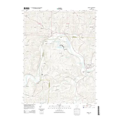
2013 Map of Beverly
USGS Topo · Published 2013About this map
The Muskingum River dominates this landscape on the border of Morgan and Washington Counties, serving as the central artery for a series of riverside settlements. In the southeast, the towns of Beverly and Waterford face one another across the water, supported by the infrastructure of the Muskingum River Lock and Dam. Moving upstream, the valley passes through historic hamlets like Swift, Beckett, and Relief, while the uplands are dotted with a dense network of family and community burial grounds, including DeLong Cem, Andrews Cem, and Milnor Cem. Industrial activity is evident near Hayward at the Muskingum River Fly Ash Reservoir and its associated impoundments. The terrain is deeply dissected by numerous runs and creeks, such as Wolf Creek, Olive Green Creek, and Hayward Run, which define the winding path of Oh-60 and various ridge roads like Righteous Ridge Rd.
Find a feature on this map
149 named features on this map. Tap any name to fly to it.
Don’t see what you’re looking for? This feature index may not catch every label — zoom into the map to look around manually.
Map Details
Editions of this 2013 Beverly Map
This is the sole edition of this map. No revisions or reprints were ever made.
Other maps of this area

1902 · Parkersburg
USGS Topo · 1:62,500

1904 · Parkersburg
USGS Topo · 1:62,500

1904 · Chesterhill
USGS Topo · 1:62,500

1906 · Chesterhill
USGS Topo · 1:62,500

1909 · Caldwell
USGS Topo · 1:62,500

1910 · Mc Connelsville
USGS Topo · 1:62,500

1912 · Caldwell
USGS Topo · 1:62,500

1949 · Clarksburg
USGS Topo · 1:250,000

1956 · Clarksburg
USGS Topo · 1:250,000

1960 · Watertown
USGS Topo · 1:24,000